The Dartmoor Way Walking Route Sections


The route is split into 10 sections with a further 2 making up the High Moor Link.
The sections mostly start and finish in the towns and villages that are located around the route enabling accommodation, shop, and hostelries to be accessed. The sections are all of a distance that offer a comfortable days walking.
Please use the route directions in conjunction with the maps. There are sections of the route that are not waymarked. These are marked on the maps and in the route descriptions. These are predominately on some of the open moorland sections where it was felt inappropriate to install waymarks.
These unmarked sections are relatively short. However, if you are unsure of undertaking these or the visibility is compromised, please use the poor weather alternatives. The High Moor Link sections do not have poor weather options as alternatives are not practical. Generally, the paths used for the unmarked sections sections are good but it is advised that these sections are undertaken in good weather conditions and that you are proficient in the use of map and compass.
The Dartmoor Way can be walked in either direction, however, the route directions are presented in an anti-clockwise direction. Ivybridge has been chosen as a recommended start point as it has a mainline railway station and is served by good bus connections.
INFORMATION ON STILES
If you have difficulty negotiating stiles, then click here for more information on stiles along the route and alternative walking options.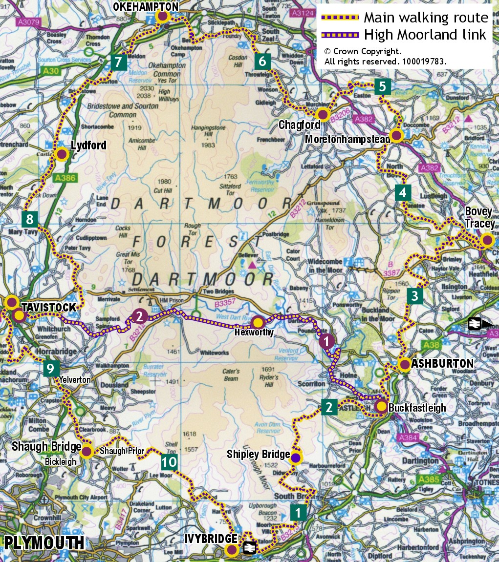
Click on the section PDFs below to open the map and route description. These can be downloaded and printed.
High Moor Link
Donations
We are suggesting a donation for the route sections downloads which will help towards the upkeep of the Dartmoor way website. To donate, click here.